Last night when I read Carly's EMPS assignment,
Rocks Or Stones, I knew where I wanted to go, but not whether I could do it. That question was answered at 8:05 AM Monday. My recruiter called to say that the CPA firm that hired me last week emailed that they were indeed pulling out of the location where I was working. I'm unemployed again. I'm disappointed about this, and a little worried, but not devastated. The silver lining, at least for the day, was that I could indulge in a fairly ambitious rockhunting excursion.
("It's not fair!" John grumbled later. "I have to work all day, and you get to go for a hike in the country!")

The Santa Catalina Mountains are a collection of rocks.
A mountain, if you think about it, is essentially a really big rock with bits broken off and stuff growing out of it. So I headed for the mountains. I've done this before for other photo challenges, but usually I've taken Catalina Highway up Mount Lemmon. This time I had a different destination in mind.

"Salt potato rocks" along Sabino Walkway.
Here we are in
Sabino Canyon Recreation Area, part of the Coronado National Forest. I used to come here several times a week in 1986, when I was new to Tucson and vaguely working on a book about local
Critters. It's probably been well over a decade since my last visit, and I've been meaning to go for some time. Sabino Canyon is only about ten miles from my house, and it's a beautiful place. I've also been interested in checking on its recovery from a major flood in 2006, which took out one of the nine stone bridges along the 3.8 mile, pedestrians-and-official-vehicles-only road. I saw little evidence of the damage today, largely because I didn't stick to the main road. I took a few of the trails instead - over two miles' worth. That doesn't sound impressive until you look at the terrain I covered, which I'll be showing you over the next few nights.

Rocks abound, especially in creek beds, making for natural building material.
The roads, bridges and buildings of Sabino Canyon were built by three Depression-era agencies: the Emergency Relief Administration (ERA), the
Works Progress Administration (WPA) and the Civilian Conservation Corp (CCC). Between 1933 and 1937 they built roads, bridges (originally called "check dams"), picnic tables, fireplaces, restrooms, a ranger station and a few other large buildings, mostly out of stone. Many of these are still around, but some were destroyed or damaged in the flood. But a group called
Friends of Sabino Canyon has been working to preserve and restore as much as possible.

One of the nine stone bridges on the main road.
Back in 1986, I used to occasionally take the tram to the top of the road, back when it cost (if I recall correctly) $3. Later I used to stick to the Lower Sabino Canyon and Bear Canyon area. Prices have gone up over the years, of course. Admission used to be free, and now there's a use fee. I bought an annual pass for not much more, so I can start coming here often - not as much as in 1986, but enough to make the pass worthwhile. I did not spring for the tram ride, which is now $8.

A rock. Not exactly an ancient petroglyph!
I started out on a trail to the right of Upper Sabino Canyon Road, called Sabino Walkway on the map. It ran parallel to the road for half a mile, and most of the many walkers and hikers were using the road instead. But I stayed on the trail, taking pictures of rocks and desert and
phainopeplas, a kind of bird that lives on mistletoe berries. It had been chilly in the city, but once I got going I was warm enough to stuff my jacket into my oversize purse, and use the latter as a knapsack.

A route to the Dam - but not the best route.
When I crossed Bear Canyon Road I saw this sign, and asked a couple of middle-aged hikers for advice. They suggested that I should keep going, and then take the main road to another trail that went down toward Sabino Dam on the right. "There's plenty of water down there," they promised.

No, I wasn't eaten by a mountain lion.
I followed their directions, and soon passed a very different sort of sign. Right after this, the road dipped rather steeply downhill, and before too long I reached Bluff Trail.

This photo doesn't really convey the angle of descent.
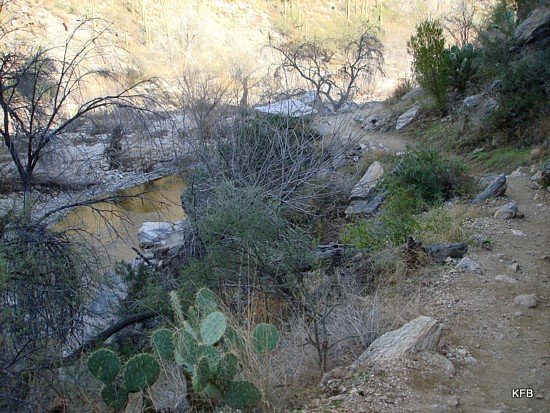
The steep beginning of it, which I remember taking on a regular basis when I was two decades younger, was a little daunting for someone who has had several seriously sprained and broken ankles since then, and done precious little hiking in recent years. But the couple I'd spoken to had been unconcerned about my ability to handle the trail, and the memory of my younger self pushed me on. After the first step, the initial stretch of the trail wasn't so bad.
And after that? It got modestly hairy at times, but the spectacular views made up for it. But you'll have to wait to see those tomorrow night, and possibly the next as well.
Karen